Joel Currie
The Edmonton, Yukon and Pacific Railroad (EY&P) is better known for its downtown to Strathcona route, but it also had a route that passed through Jasper Place on its way to Stony Plain.
The Railway had its beginnings in 1896 with the incorporation of the Edmonton District Railway Company. It was renamed in 1899 when its charter was changed to permit the company to build a line to the Yukon River and to the Pacific Coast.
In 1901, the EY&P constructed a line from Strathcona, down Mill Creek Ravine and across the Low Level Bridge, and then stopping at their station a short distance from the bridge. The railway had the distinction of having the first line to cross the North Saskatchewan River at Edmonton. The EY&P’s original Edmonton to Strathcona line remained in use until June 11, 1952 (4). Its route through the Mill Creek Ravine is now a paved bike and walking path.
In 1903, the line was expanded such that it slowly climbed the north slope of the river valley, reaching the top around 125 Street. It then headed northeast to the Canadian Northern station near what is now 104 Avenue. In 1906, the EY&P graded a roadbed from central Edmonton, through Jasper Place, Spruce Grove and Stony Plain to a point near Wabamun Lake. Tracks were only laid as far as Stony Plain with the line opening in 1907. The EY&P was amalgamated with the Canadian Northern Railway (CNoR) in 1909.
In 1918, CNoR came under federal government control and became known as the Canadian National Railway (CNR). CNR also acquired Grand Trunk Pacific, which resulted in the CNR having two lines from Edmonton to Stony Plain. In 1923 (2,3), the old EY&P track west of 142 Street, which had been laid without ballast (1), was abandoned by CNR.
The EY&P east of 142 Street remained in use for almost three decades after it was taken up to the west. The portion between the CNR rail yards and 142 Street may have been retained to turn trains around (6). During World War II, a north-heading spur was attached just west of 142 Street to service some newly constructed warehouses (6). Aerial photos show it to have been about a mile and half long.
The railroad passed through Jasper Place at an angle of about 6 degrees South of West. It ran through the south part of the property on which Canora School would be built in 1949. A student at the school, Barrie Touchings, recalls the railroad berm still being present for some time:
In the early days there used to be a railroad line that went just north of 105th Avenue…. I do remember that the berm for the line – the raised area where the tracks ran – ran through the Canora School grounds. There was this mound that would be three or four feet high when I was young, ten feet wide. It ran from Canora School east to 154th Street and it ran west of the school up to the alley between 155th and 156th Street. There was a distinct raised area, obviously a former bed for a railroad line. I do remember that one of the Zaloskis, who were neighbours of ours, one of the kids, found a spike from the old line, and had that saved for a number of years. But that line was definitely there and I remember it.
The name Canora, itself, is derived from the first two letters of the name Canadian National Railway. It had been used in 1905 as the name of a town in Saskatchewan (5) and for the ferry, the SS Canora, operated by CNoR to Vancouver starting in 1918 (1). In 1949, derived the same way, “Canora” became the name of the neighbourhood and school in Jasper Place.
The EY&P also crossed the north end of Britannia School property, but all signs of the berm were eliminated when the school was built in 1957.
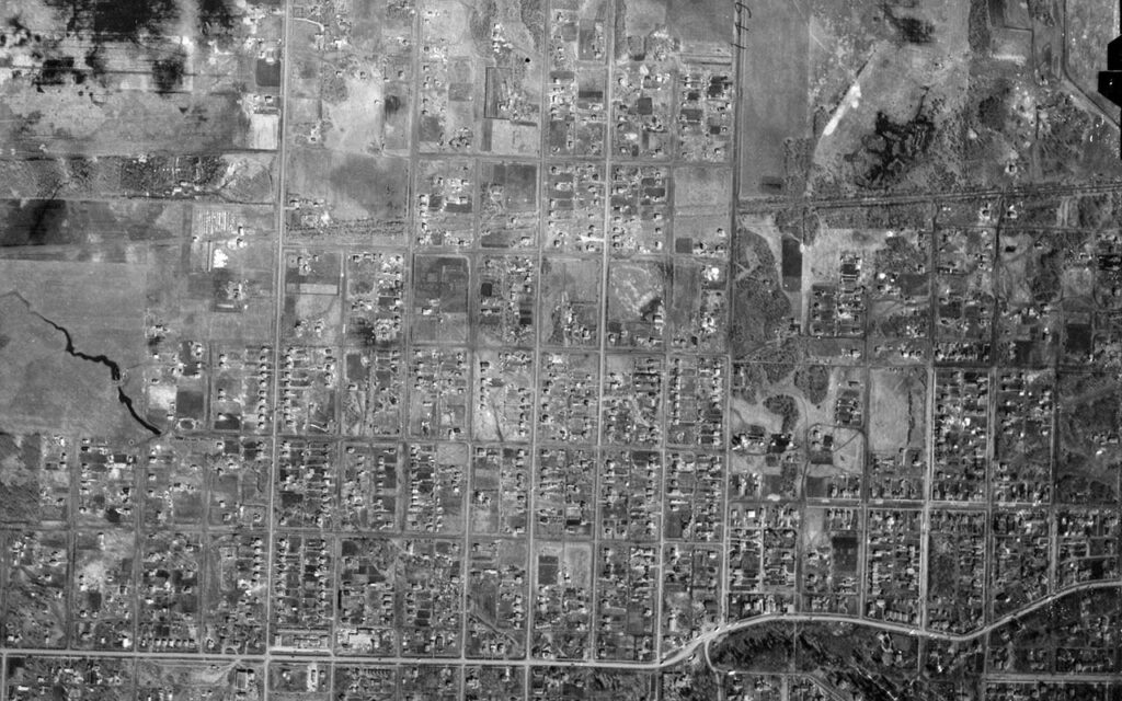
Though the berms were removed from these yards, a faint line on the ground can be seen in aerial photographs as late as 1988. Lines in the Canora yard can be seen in a 2017 satellite image, and one of these lines can still be seen of the Britannia School yard in current Google satellite images. Other than the aforementioned satellite image, there are a few houses and fences east of Canora School that are built at a 6-degree angle where the tracks used to be. Unfortunately, there are few traces left of the line in Jasper Place.
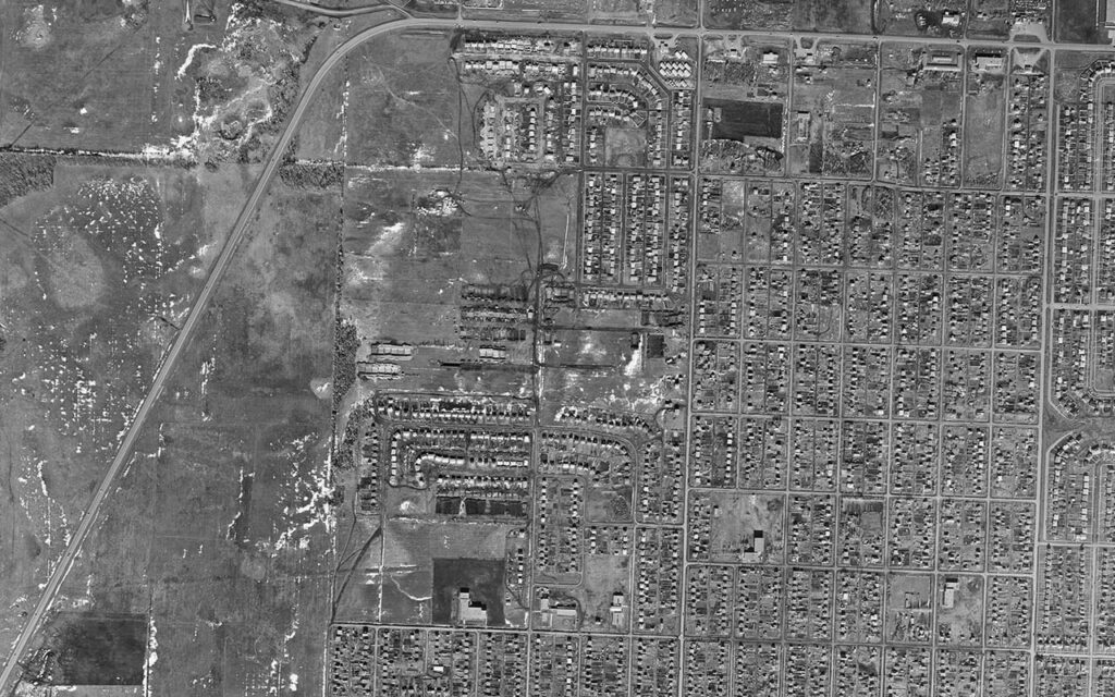
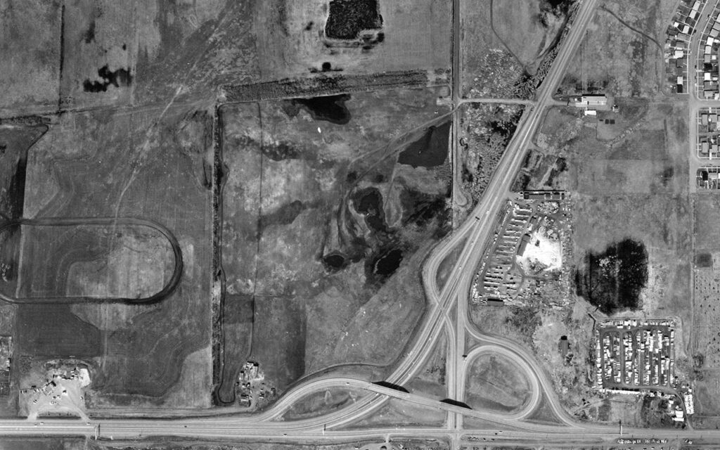
However, there are places west of the Jasper Place area that show signs of the railroads past, such as lots between 178 and 184 Streets with a 6-degree line running through them where the tracks passed through, which are more clearly visible in the 1965 aerial photo below.
References
1) Buck, George H., From Summit to Sea: An Illustrated History of Railroads in British Columbia and Alberta, 1997. Calgary: Fifth House Ltd. P91-93, p. 102 [available via archive.org].
2) “The Edmonton, Yukon and Pacific Railway,” Atlas of Alberta Railways, University of Alberta Press, 2005. [available here: https://epe.lac-bac.gc.ca/100/205/300/atlas_of_alberta_railways/06-02-07/railways-atlas.tapor.ualberta.ca/cocoon/atlas/default.htm?nodisclaimer=1, retrieved April 2026].
3) Spencer, Christopher, “The Klondike Connection: A History of the Jasper Place Railway” SPURR, v2, no 7, September 2009, p. 14. [.pdf here, reproduced with permission].
4) Olson, Jan, “The Millcreek Ravine,” http://strathconacommunity.ca/our-neighborhood/ravine/ [Retrieved April 2026].
5) “CN Station House Museum,” http://www.tourismsaskatchewan.com/listings/2898/cn-station-house-museum. [Retrieved April 2026)].
6) Côté, Jean E, How Edmonton’s West End Began: A Hidden History, Edmonton, AB: Juriliber, 2023, pp. G2-G3.
Joel Currie grew up in Lynnwood and studied at the University of Alberta. He enjoys visiting museums around Alberta to learn about the history of those communities.
Do you have any comments about this article or memories to share? Click here.